Example Property Assessment
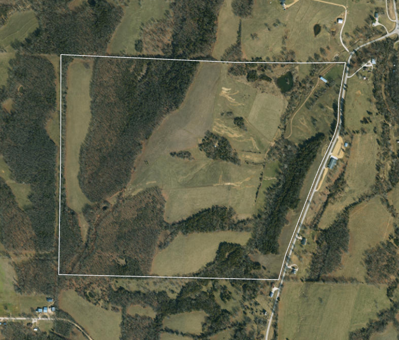
This property was previously used for a cattle operation. While the new landowner’s goal is to maximize habitat for all wildlife, the primary goal is increasing the deer and turkey hunting quality. There are existing ladder stands and ground blinds, but as you will see below, the access is quite invasive. A hunter would have to move through the entirety of the property, cross several existing travel corridors.
Upon assessing the property in person, we found that the property layout is strong, but the habitat is lacking for all wildlife and access for deer hunting is poor. However, if we restructure the existing habitat and add food plots in strategic locations, we can increase the number of different species of wildlife on the property and amplify the hunting quality.
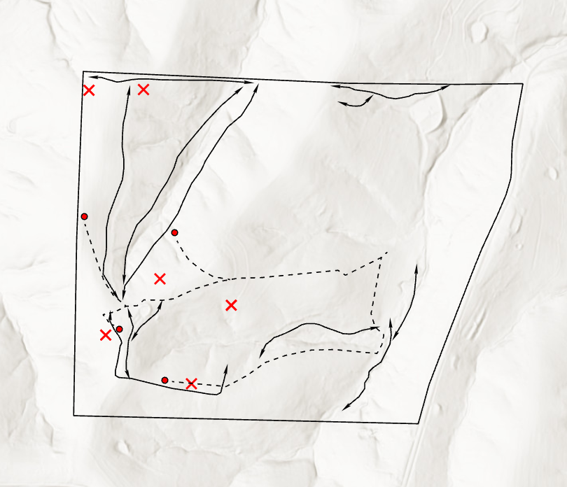
As we navigated this property, we were able to capture multiple deer trails. Additionally, the landowner gave us locations of successful turkey hunts, which are located at the red X’s. Once we added the trail and harvest data to the elevation map to the right, it shows trends that are truly invaluable. Below are four key takeaways:
The deer trails avoid the open pastures entirely. This follows the common understanding that cover and security are very important to them. Furthermore, the trails are in between the crest of the ridge and the valley.
Near the southwest corner, there is a heavy concentration of deer trails, several of which come together in a single location. This stood out to us as a very good location to add a food source, or a stand location at a minimum.
The turkey harvests are heavily concentrated to the western end of the property. This end of the property would be an ideal place to focus on implementing turkey habitat in conjunction with deer habitat.
The dashed lines are the driving / walking access to and from the stand locations, which are marked by the red dots. Take note of how intrusive some of these routes are, and how many trails you have to cross as you move to the hunting locations. Ideally, the hunter’s access would never cross the travel corridors.
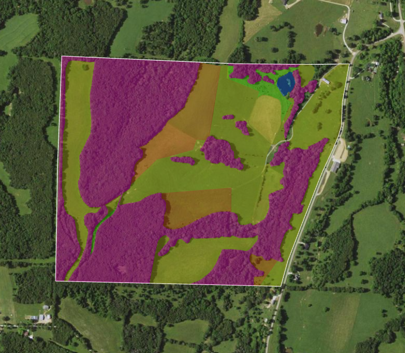
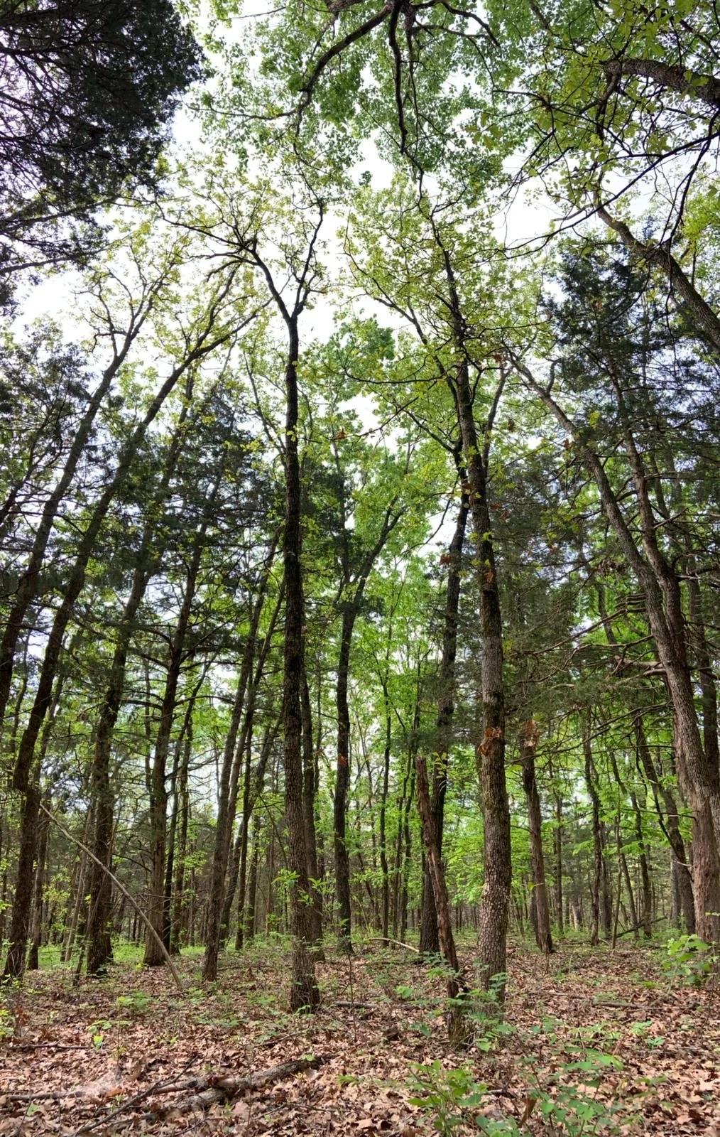
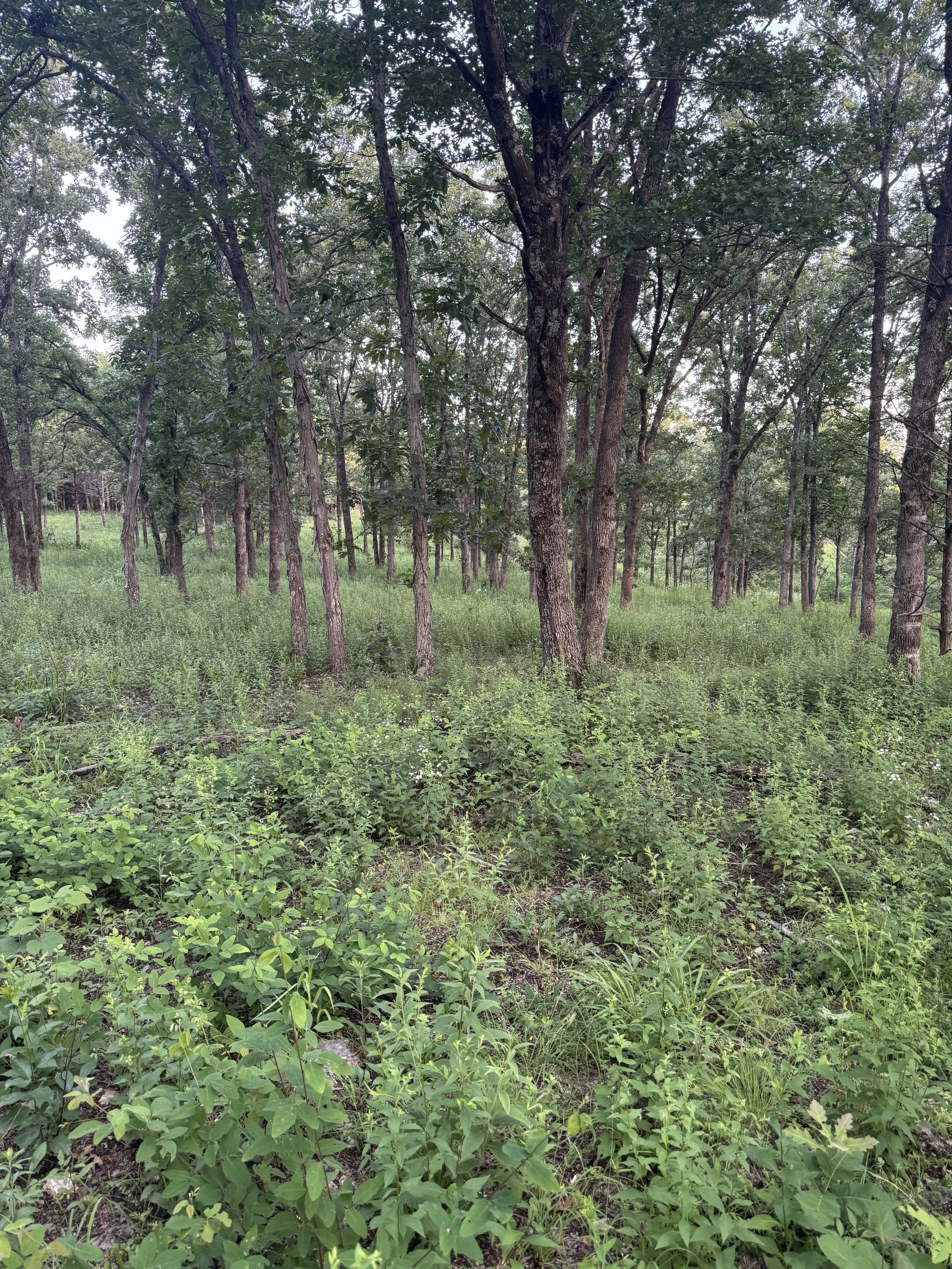
On this map, we captured all the habitat types present on the property. The landowner has a fair number of wooded areas, but the primary issue with those areas is that the canopy is completely closed. There are some quality oaks and hickories in the woods, but the forest floor is a biological desert. Below you will see two photos, one from this property and one from another property. The comparison will show the extreme contrast between the biological desert and true ground diversity. The closed canopy prevents sunlight from reaching the forest floor, which prevents native forbs, grasses and wildflowers from growing. Wildlife will make do with what they have, but they don’t prefer to live like that. By removing 40% - 60% of the canopy, we can stimulate the growth of native vegetation.
Another very important takeaway is the edges between one habitat type and another. Take note of how rigid the edges are - this is not optimal. Wildlife desire multiple layers or pockets of diversity all around them. Implementing edge feathering and tree canopy thinning on these edges, along with removing the “geometric” boundaries of these different habitat types, would greatly increase the habitat value, which would keep wildlife on the property for longer periods of time.
Biological Desert
Biological Diversity
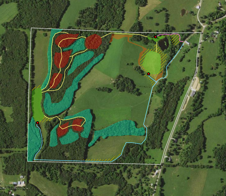
On this map, you will see the result of restructuring a portion of this property. This is not fully comprehensive, but it captures the depth of the decision making we implement. The larger the property, the more gravity every decision holds. Below is a legend with key takeaways:
The yellow hatched areas are proposed switchgrass planting locations. These provide screening for food plots, which can add to a deer’s sense of security and can keep them in the food plots longer than normal. They also serve as screening for your movement to and from the stand locations.
The green areas are new food plots. They don’t currently exist on the property, but they will become central hubs for daily wildlife movement if hunted correctly.
The red areas are where bedding areas would be created.
The orange areas are tree plantings. These are primarily for screening wildlife movement, but they also add to the diversity in a given area.
Along with the bedding areas, we structured travel corridors - the yellow lines. These are placed very deliberately; our goal is to define wildlife movement to and from bedding areas and food plots.
The pink line is the stand access route strictly on winds out of the south. The blue line is the stand access route for winds out of the north. Wind-based access is crucial for deer hunting.
The blue areas are where 40% - 60% of the forest canopy will be removed. You’ll notice we aren’t thinning the canopy across the board; this is deliberate. We want to create pockets or zones of diversity. Most wildlife are edge creatures, so we want to retain some of the edges between habitat types. They add to the diversity, and they also follow the travel corridors. These areas will contain early successional growth, a habitat that is crucial for deer and turkeys year-round.